4.6. Plant Accession
The third set of fields in TPPS is the Plant Accession section, where users upload information about where plants are located. The form fields and their properties are as follows:
Plant Accession:
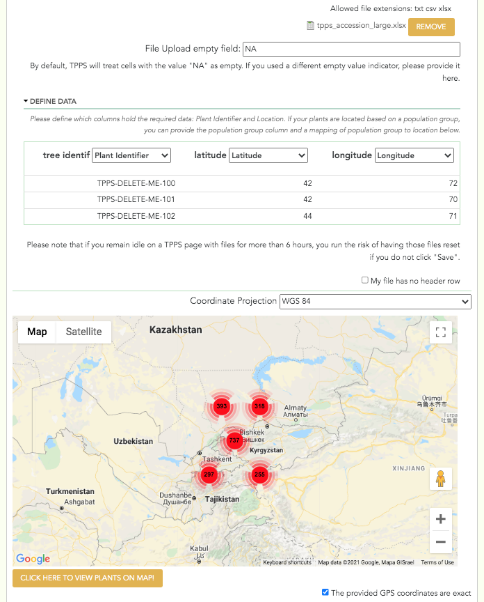
fieldset- only visible if number of species in Publication and Species Interface is 1, or if the ‘Separate Plant Accession’ checkbox is unchecked.Plant Accession File:
managed_file- spreadsheet of plant locationsPlant Accession Columns:
fieldsetofselectelements - user will define which of their columns contain the Plant ID, and which of their columns contain location information. If the number of species is >1, user will also define which of their columns contain the genus and species of each plant.Coordinate Projection:
select- options ‘WGS 84’, ‘NAD 83’, ‘ETRS 89’. Only visible if ‘Latitude’ or ‘Longitude’ columns are selected in ‘Plant Accession Columns’Map Thumbnail: Google Maps iframe that allows the user to visually validate the plant locations they have provided
Separate Plant Accession:
checkboxSeparate Plant Accession Information:
fieldset- only visible if the ‘Separate Plant Accession’ checkbox is checkedPlant Accession File x:
managed_file- spreadsheet of plant locations of species xPlant Accession Columns x:
fieldsetofselectelements - user will define which of their columns contain the Plant ID, and which of their columns contain location information